Our Guide to Popular Fishing Marks
Balcary - Dumfries & Galloway
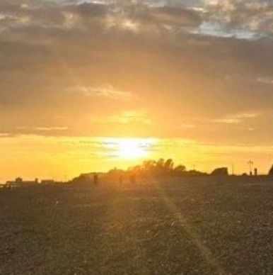
Bog Hall Rocks - Northumberland
Bog Hall Rocks - Northumberland
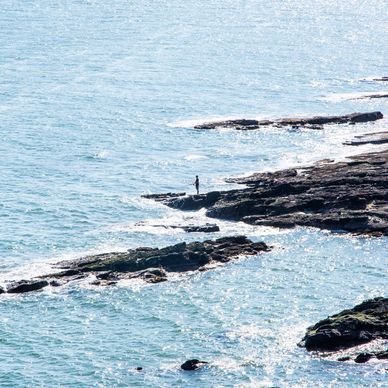
Parking - Next to a farmhouse, accessible 24/7.
Tides - Bigger tides create a strong run that can make holding bottom very difficult. However, it can be fished on most tides, making it a reliable venue throughout the year.
Winds - Fishing in strong head-on winds can be very dangerous due to swell washing onto the rocks and sessions should be avoided in these conditions.
Bog Hall Rocks - Northumberland
Bog Hall Rocks - Northumberland
Bog Hall Rocks - Northumberland
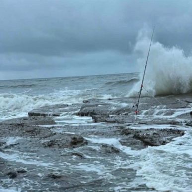
Parking - along Creswell Road.
Tides - Fish 3 hours down, 2 hours up, tide sizes are best medium with lows of around 1.2m which leaves plenty of water in front of you and doesn't drain right out.
Winds - Best weather to aim for on this mark is a nice south easterly swell over low.
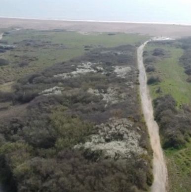
Stout Point - Llantwit Major
Bog Hall Rocks - Northumberland
Stout Point - Llantwit Major
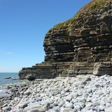
Parking - Rosedew Farm CF61 1PZ.
Tides - Low water medium to bigger tides. (Cardiff scale 11.5m up to the biggest of the year generally bigger the better)
Winds - Northerly is about most comfortable as it's over your back but anything is ok as long as it's not blowing a gale, Southerly being the worst as it's in the face, just be careful of wind speeds before going.
Bendricks Rock - Barry
West Thurrock - The Thames
Stout Point - Llantwit Major
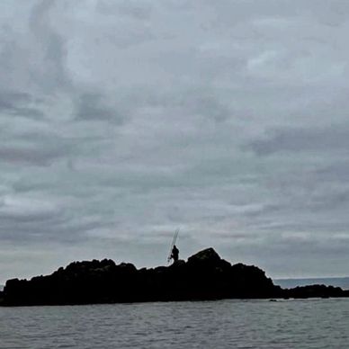
Parking - along Atlantic Trading Estate Road.
Tides - Medium to big tides over low, over high water, the rock can be fished on medium tides max 14m but I would advise not to do it unless you are fully competent. Also phone the coastguard to inform them you are fishing over high just in case pedestrians phone in thinking you are stranded.
Winds - Best weather will be any northerly wind over high water, over low any wind other than a dreaded easterly.
West Thurrock - The Thames
West Thurrock - The Thames
West Thurrock - The Thames

Parking - Access to west Thurrock is behind the Procter and Gamble factory with free parking in the car park.
To get the mark it’s a walk of around 10-15 minutes through the small woods and then to the right along the seafront, along the way you’ll pass some amazing graffiti murals and just keep walking until you reach a long grassed area and gentle sloping bank between two working Jetties about 500m apart from each other, this is where you fish from.
Again this is a high water mark fishing over very soft mud, DO NOT go onto the mud for any reason here as it is very unsafe!
Rainham - The Thames
West Thurrock - The Thames
West Thurrock - The Thames

Parking - Rainham green bin is accessed via a short walk from the free Purfleet riverfront car park situated off of Cold Harbour lane RM13 9BJ, you can literally see the river and the banks to fish from as soon as you head from the car.
Fishing can be from anywhere spread over the seafront to the right from the grass banks spread out for around 500m and is easy access with safe firm banks under foot.
The marshes are situated to the left as you look at the river and can be accessed by the sea walk path, fishing along the marshes you need to locate the firmer banked areas and you will get less time over the top of the tide due to the larger mud flats, medium sized building tides are your best bet for the marshes and green bin.
Grays - The Thames
Eastney Beach - Portsmouth
Tilbury Fort - The Thames

Parking - In the Wharf car park which is run by your parking space.
Essex, RM17 6SZ. Marks at Grays are the Promenade, wharf and platform marks.
Both the Wharf and promenade offer easy access with a short walk and comfortable fishing from the square in front of the Wharf pub or a short walk to the right along the sea wall to the promenade wall, the platform is around 300m further past the promenade and is accessed by climbing over the small seafront access steps at the Exolum Jetty 2. Once over the wall at the steps there are two paths that have been worn out of the shrubbery leading to the front of the platform, the platform itself is again a solid and comfortable base to fish from.
Tilbury Fort - The Thames
Eastney Beach - Portsmouth
Tilbury Fort - The Thames

Parking - The fort is accessed very easily by way of the free car park. RM18 7NR which is literally situated a stones throw from the wall that you will fish from.
Fishing the fort is from the sea defence wall off of hard ground and is very much easy going, as you are heading further down the river the water will is deeper in front of you here and the tide can pull stronger than the spots further up the river.
Eastney Beach - Portsmouth
Eastney Beach - Portsmouth
Chesil Cove to Ferrybridge - Chesil
Parking - all along the front.
Tides - Best fished from low to high, or first 3 hours after low. Best on small and medium tides.
Eastney beach is a 2 mile stretch of beach on the east coast of Portsmouth. It offers fairly shallow clean ground/sand and depending on the time of year it can cough up a wide range of fish, and the occasional monster.
Chesil Cove to Ferrybridge - Chesil
Chesil Cove to Ferrybridge - Chesil
Chesil Cove to Ferrybridge - Chesil

Parking - Car park postcode – DT5 1AR.
The Portland end of Chesil which runs from Chesil cove through to Ferrybridge can be accessed by a couple of different pay for parking car parks along with a couple of off the main road parking places, as with all of chesil beach its generally a taxing walk over the shingle to get to the water’s edge although right up in the cove does offer slightly easier access.
Throughout this stretch of the “big beach” the fishing grounds are possibly the most varied in terms of bottom make up and species to aim for than any other area along the entire length of chesil. Chesil Cove is the start point at the east end of Chesil, it is known for holding mixed, to rough ground and as you move from the Cove towards Ferrybridge the bottom changes to primarily being made up of mixed shingle with sandy areas further out still with the occasional rough patch.
Having such varied grounds to fish over coupled with the geography of being situated at the far end of the beach with the Portland race off to one side and the fall out from the whole of chesil beach to the other means that on its day this whole area can throw up some special along with surprising catches and this has been proven many times over throughout the years.
Ferrybridge - Chesil
Chesil Cove to Ferrybridge - Chesil
Ferrybridge - Chesil

Parking - Car Park Postcode – DT4 9XE.
Access to the beach from the paid parking area is a bit of a trek up the wooden walkway and then across the shingle, the walk over the shingle to access the water is slightly further than most other marks along Chesil but the effort can definitely see rewards as on its day the Ferrybridge area can turn up some truly magical fishing.
Like all of the “Big Beach” fishing is from the shingle with this particular area having generally a much steeper shingle bank descending down to the water’s edge, fishing is into relatively deep water all along and good sport can be found anywhere from the left of the car parking area all the way to as far as you can walk to the right (looking out to sea) up to the renowned deep area of the Bridging Camp.
Geographically Ferrybridge is the start point of the Fleet and for those who don’t know this is a large expanse of water that runs adjacent to the sea for over 8 miles and effectively closes off access to the actual beach by foot until its end point at Abbotsbury.
.
Abbotsbury - Chesil
Chesil Cove to Ferrybridge - Chesil
Ferrybridge - Chesil

Parking - Car Park Postcode – DT3 4LA.
As you enter the Abbotsbury car park you will be greeted by the café on your right hand side and also will find there is a clean public toilet within the car park, the car park itself is pay on arrival and do be warned there are cameras operating so once you enter even if only for a very brief stay you need to ensure you pay. Once parked and your gear is ready you will have a few options in terms of accessing the beach and depending on how fit you are feeling you can venture from a relatively walk across the shingle to the full trek to the Dragons teeth and beyond.
Firstly if opting for the easier shorter walk you can use the wooden walkway from the car park sited near the toilet area to get you up over practically half of the shingle and then head straight down to the water in the near vicinity, if you are doing the considerably longer walk to the Dragons teeth which is east of the car park and beyond there are two different routes you can take, firstly if it is very near to low water on a medium to big tide you can take the same wooden pathway straight down onto the shingle and then walk on or just below the high water line, the beach at this point is firmer under foot and this will in turn make the walk much easier, likewise you can take this route if heading back to your car at low water also.
West Bexington - Chesil
St Catherines Breakwater - Jersey
West Bexington - Chesil

Parking - Car park postcode – DT2 9DG.
West Bexington has a good sized pay for parking car park which unlike much of the rest of Chesil offers a view straight over the beach and your potential fishing spots, accessing the shoreline is again in comparison to some of the other well known and well used Chesil marks relatively easy going with a slightly flatter shingle slope heading down to the water. Good fishing can be found right along this stretch of coast from a very short walk right in front of the car park to a further trek either east or west for those wanting to move a little bit further away from the crowds. It is definitely worth noting on this mark that owing to the easy access and the pleasant amenities such as a nice shop it can at times become quite busy at and getting there early in the morning for a day session is well advised.
Cogden Beach - Chesil
St Catherines Breakwater - Jersey
West Bexington - Chesil
Parking - Car park postcode – DT6 4RL.
Cogden beach is accessed via a small pay for parking carpark and then a fair downhill walk along the coastal path to the shorefront, the walk is easy heading to the beach but be warned the return leg back to the car is much more taxing as it is all uphill!
Situated towards the eastern end of the big beach, Cogden like the surrounding nearby West Bexington to the West and Burton and Bradstock further to the East is shallower than the eastern end and offers smoother more gentle sloping shingle to fish from, you can fish anywhere along the beach to the left or right as you approach the shorefront.
St Catherines Breakwater - Jersey
St Catherines Breakwater - Jersey
St Catherines Breakwater - Jersey
St Catherine's Breakwater is a venue for everyone. Easy access, free parking, and public toilets at either end make it very user friendly, there's even a café.